
Mapa topográfico Sparta Township
Mapa interactivo
Haga clic en el mapa para ver la altitud.
Sparta Township
The elevation of Sparta Township ranges from a low of 1,320 feet at East Branch of Oil Creek to 1,913 feet (also highest point in Crawford County) in the northeastern part of the township. Eastman Hill, in the eastern part of the township, is the most prominent ridge in the township. Tributaries of Oil Creek, such as Stranahan Run, Patrick Run, Coon Run, Britton Run, Twomile Creek, and Fivemile Creek, drain most of the township with a small portion in the northeastern part being drained by Brokenstraw Creek tributaries. Wetlands in the county are mostly clustered around Clear Lake with smaller amounts along Fish Flats at Fivemile Creek and an area in the southeast part of the township.
Acerca de este mapa
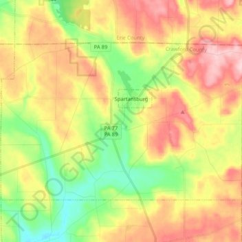
Nombre: Mapa topográfico Sparta Township, altitud, relieve.
Altitud media: 483 m
Altitud mínima: 391 m
Altitud máxima: 584 m