
Mapa topográfico Vill
Mapa interactivo
Haga clic en el mapa para ver la altitud.
Acerca de este mapa
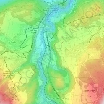
Nombre: Mapa topográfico Vill, altitud, relieve.
Lugar: Vill, Innsbruck, Tirol, Österreich (47.21208 11.38732 47.24851 11.41604)
Altitud media: 827 m
Altitud mínima: 601 m
Altitud máxima: 1.139 m
Otros mapas topográficos
Haga clic en un mapa para ver su topografía, su altitud y su relieve.
Innsbruck
Österreich > Tirol > Innsbruck
Innsbruck, Statutarstadt Innsbruck, Tirol, Österreich
Altitud media: 611 m