
Mapa topográfico LaGrange
Mapa interactivo
Haga clic en el mapa para ver la altitud.
Acerca de este mapa
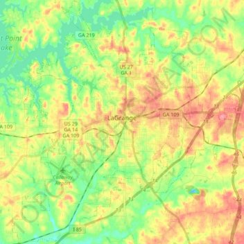
Nombre: Mapa topográfico LaGrange, altitud, relieve.
Lugar: LaGrange, Troup County, Georgia, United States (32.96588 -85.10746 33.10750 -84.94995)
Altitud media: 220 m
Altitud mínima: 181 m
Altitud máxima: 266 m
LaGrange is named after the country estate near Paris of the wife of the Marquis de La Fayette. When La Fayette, a Revolutionary War hero, visited Georgia in 1825 on a national tour, he remarked on the similarity of local topography to his wife's property.