
Mapa topográfico La Spezia
Mapa interactivo
Haga clic en el mapa para ver la altitud.
Acerca de este mapa
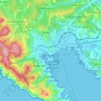
Nombre: Mapa topográfico La Spezia, altitud, relieve.
Lugar: La Spezia, Follo, La Spezia, Liguria, Italy (44.06381 9.76370 44.15154 9.89235)
Altitud media: 179 m
Altitud mínima: -2 m
Altitud máxima: 771 m
Because of its topography, the city is not exposed to winds from the north, which lap western Liguria, but to those from the southeast. These may bring heavy rain and they can reach 80 kilometres per hour (50 mph), in rare cases causing the blocking of the port. The only northern wind reaching the city is the north-eastern Grecale, common during incursions of Arctic air, when the cold air flowing over the warmer Tyrrhenian sea triggers the formation of low pressures, draining the colder and heavier air trapped in the Po Valley, behind the Apennine Mountains.