
Mapa topográfico Fish Lake
Mapa interactivo
Haga clic en el mapa para ver la altitud.
Fish Lake
Fish Lake is a high alpine lake (elevation approximately 8,848 ft or 2,700 m) located in the Fishlake/ Southern Wasatch Plateau region of south-central Utah, United States. It lies within and is the namesake of the Fishlake National Forest.
Acerca de este mapa
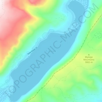
Nombre: Mapa topográfico Fish Lake, altitud, relieve.
Lugar: Fish Lake, Sevier County, Utah, United States (38.51973 -111.73857 38.58301 -111.67746)
Altitud media: 2.886 m
Altitud mínima: 2.694 m
Altitud máxima: 3.438 m