
Mapa topográfico FFH Mittleres Zwickauer Muldetal (Teilfläche 4: Wiese bei Bräunsdorf)
Mapa interactivo
Haga clic en el mapa para ver la altitud.
Acerca de este mapa
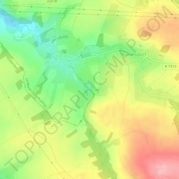
Nombre: Mapa topográfico FFH Mittleres Zwickauer Muldetal (Teilfläche 4: Wiese bei Bräunsdorf), altitud, relieve.
Altitud media: 326 m
Altitud mínima: 265 m
Altitud máxima: 386 m