
Haz una donación
Equípate para tu próxima aventura:
Como asociado de Amazon, este sitio gana comisiones por las compras que califican, sin ningún costo adicional para usted.
Mapa topográfico Hoh Xil
Haga clic en el mapa para ver la altitud.
Haz una donación
Equípate para tu próxima aventura:
Como asociado de Amazon, este sitio gana comisiones por las compras que califican, sin ningún costo adicional para usted.
Hoh Xil
The region covers 83,000 square kilometres at an average elevation of 4,800 metres above sea level, stretches in a meridional (east-west) direction between the Tanggula and Kunlun mountain chains in the border areas of southwest China's Tibet Autonomous Region, northwest China's Qinghai Province and China's Xinjiang Uyghur Autonomous Region. The southeastern part of the Hoh Xil, drained by the Chumar River (楚瑪爾河), is one of the major headwater sources of the Yangtze River. The rest of the region is endorheic, with drainage to numerous isolated lakes; this area is sometimes described by hydrologists as the "Hoh Xil lake district". 45,000 square kilometres of the Hoh Xil region, at an average elevation of 4,600 metres, were designated a national nature reserve in 1995. The UNESCO World Heritage Site is encompassed of the western half of Zhidoi County and western part of Qumarlêb County in Qinghai. Bukadaban Feng is considered part of Hoh Xil.
Haz una donación
Equípate para tu próxima aventura:
Como asociado de Amazon, este sitio gana comisiones por las compras que califican, sin ningún costo adicional para usted.
Acerca de este mapa
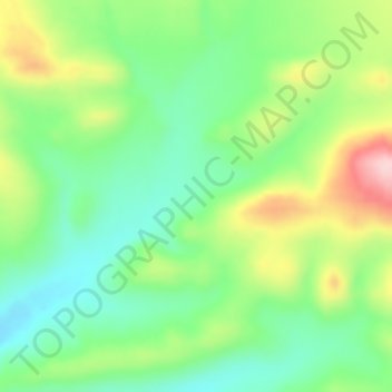
Nombre: Mapa topográfico Hoh Xil, altitud, relieve.
Altitud media: 4.768 m
Altitud mínima: 4.690 m
Altitud máxima: 4.903 m
Haz una donación
Equípate para tu próxima aventura:
Como asociado de Amazon, este sitio gana comisiones por las compras que califican, sin ningún costo adicional para usted.