

Mapa topográfico Bruny Island
Haga clic en el mapa para ver la altitud.
Bruny Island
Outside its settlements, the island is covered with grazing fields and large tracts of dry eucalyptus forest. Inland forests have been logged, but other large sections—mostly along the southeastern coast—are preserved as the South Bruny National Park. While the seaward side of the island features two long beaches—Adventure Bay and Cloudy Bay—it is for the most part extremely rugged, with cliffs of dolerite over 200 metres (660 ft) AHD in altitude. Bruny's channel side is more sheltered and a favourite fishing and recreational boating area for local and interstate visitors. Adventure Bay is located on the eastern side of the isthmus, while Isthmus Bay is located on the western side.
Acerca de este mapa
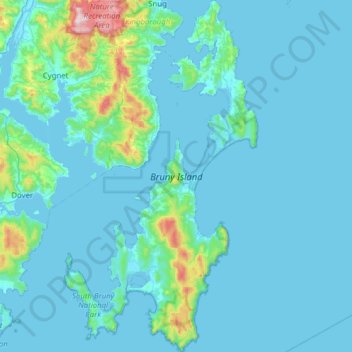
Nombre: Mapa topográfico Bruny Island, altitud, relieve.
Altitud media: 60 m
Altitud mínima: -3 m
Altitud máxima: 806 m