

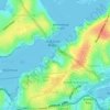
Mapa topográfico Cammeray
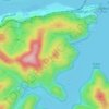
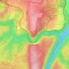
Haga clic en el mapa para ver la altitud.
Cammeray
Prior to the 1920s, the suburb was known as Suspension Bridge reflecting the now Long Gully Bridge that joined Northbridge to Cammeray. Cammeray was slow to develop mainly due to its steep topography and remoteness from transport.
Acerca de este mapa

Nombre: Mapa topográfico Cammeray, altitud, relieve.
Altitud media: 66 m
Altitud mínima: -4 m
Altitud máxima: 104 m
Otros mapas topográficos
Haga clic en un mapa para ver su topografía, su altitud y su relieve.





























St Leonards Park
Australia > New South Wales > Sydney > North Sydney
In 2018 it was announced that North Sydney Council would commence an upgrade of the park including improving the war memorial with a reflection pool, restoration of the Tunks Fountain and elevation on a new plinth, new benches, picnic tables, barbecues and drinking fountains, upgrades to lighting, additional…
Altitud media: 61 m


