
Haz una donación
Equípate para tu próxima aventura:
Como asociado de Amazon, este sitio gana comisiones por las compras que califican, sin ningún costo adicional para usted.
Mapa topográfico Shiloh
Haga clic en el mapa para ver la altitud.
Haz una donación
Equípate para tu próxima aventura:
Como asociado de Amazon, este sitio gana comisiones por las compras que califican, sin ningún costo adicional para usted.
Shiloh
Shiloh is located west of the center of DeKalb County at 34°27′56″N 85°52′38″W / 34.46556°N 85.87722°W / 34.46556; -85.87722 at an elevation of 1,263 feet (385 m). It is bordered to the northeast by the city of Rainsville and to the southwest by the town of Fyffe. Alabama State Route 75 passes through Shiloh, connecting Rainsville and Fyffe.
Haz una donación
Equípate para tu próxima aventura:
Como asociado de Amazon, este sitio gana comisiones por las compras que califican, sin ningún costo adicional para usted.
Acerca de este mapa
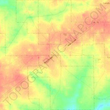
Nombre: Mapa topográfico Shiloh, altitud, relieve.
Lugar: Shiloh, DeKalb County, Alabama, United States (34.45012 -85.89501 34.48078 -85.85989)
Altitud media: 378 m
Altitud mínima: 352 m
Altitud máxima: 394 m
Haz una donación
Equípate para tu próxima aventura:
Como asociado de Amazon, este sitio gana comisiones por las compras que califican, sin ningún costo adicional para usted.