Geolocalizar

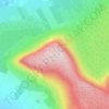
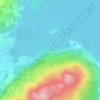
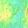
Mapa topográfico Carrowclare

Haga clic en el mapa para ver la altitud.

Acerca de este mapa

Nombre: Mapa topográfico Carrowclare, altitud, relieve.

Lugar: Carrowclare, Streamstown ED, Ballymote-Tubbercurry Municipal District, County Sligo, Connacht, Ireland (54.08994 -8.66842 54.09821 -8.65424)

Altitud media: 76 m

Altitud mínima: 53 m

Altitud máxima: 123 m

Otros mapas topográficos

Haga clic en un mapa para ver su topografía, su altitud y su relieve.
Ballynacarrow

Ireland > County Sligo

Altitud media: 72 m

Rathcormack

Ireland > County Sligo

Altitud media: 27 m

Benbulbin

Ireland > County Sligo

Altitud media: 257 m

Geevagh

Ireland > County Sligo

Altitud media: 92 m

Dooney Rock

Ireland > County Sligo

Altitud media: 53 m

Beltra

Ireland > County Sligo

Altitud media: 19 m

Coney Island

Ireland > County Sligo

Altitud media: 1 m

Kesh

Ireland > County Sligo

Altitud media: 122 m

Garavogue

Ireland > County Sligo

Altitud media: 20 m

Rosses Point

Ireland > County Sligo

Altitud media: 4 m

Geevagh

Ireland > County Sligo

Altitud media: 92 m

Carrane Hill

Ireland > County Sligo

Altitud media: 324 m

Easky

Ireland > County Sligo

In Samuel Lewis's 1837 publication of A Topographical Dictionary of Ireland, Easky was described as having 6,124 inhabitants, of which 289 were in the village. Lewis noted that the village (made up of one long street) had petty sessions every fortnight and that Wednesday was market day. As well as other more…

Altitud media: 17 m
Equípate para tu próxima aventura:

🔦Farolillos de Camping - Iluminación ambiental para tu zona de acampada
🗺️Fundas Portamapas Estancas - Lee tus mapas bajo la lluvia sin dañarlos
🚿Toallas de Microfibra - Secado rápido y ocupan el mínimo espacio
🚲Kits de Limpieza de Bicicleta - Mantenimiento para tu compañera de rutas
📢Silbatos de Emergencia - Házte oír en caso de rescate o pérdida en la montaña

Como asociado de Amazon, este sitio gana comisiones por las compras que califican, sin ningún costo adicional para usted.