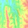
Mapa topográfico MacDonnell Ranges
Haga clic en el mapa para ver la altitud.
MacDonnell Ranges
The highest peaks are Mount Zeil with an elevation of 1,531 metres (5,023 ft) AHD, Mount Liebig at 1,524 metres (5,000 ft) AHD, Mount Edward at 1,423 metres (4,669 ft), Mount Giles at 1,389 metres (4,557 ft) and Mount Sonder at 1,380 metres (4,530 ft) AHD; the five highest mountains in the Northern Territory. The headwaters of the Todd, Finke and Sandover rivers form in the MacDonnell Ranges. The range is crossed by the Australian Overland Telegraph Line, the Stuart Highway and the Adelaide–Darwin rail corridor at the Heavitree Gap, a water gap created by the Todd River, at the southern entrance to Alice Springs.
Acerca de este mapa
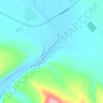
Nombre: Mapa topográfico MacDonnell Ranges, altitud, relieve.
Altitud media: 594 m
Altitud mínima: 562 m
Altitud máxima: 715 m
Otros mapas topográficos
Haga clic en un mapa para ver su topografía, su altitud y su relieve.
Sydney
Sydney's topography is characterized by a diverse landscape that seamlessly blends coastal features with inland plateaus. The city is divided into two primary regions: the relatively flat Cumberland Plain to the south and west of Sydney Harbour, and the elevated Hornsby Plateau to the north. The Cumberland…
Altitud media: 53 m
City of Melbourne
Melbourne's topography is characterized by a diverse landscape that transitions from flat coastal plains to rolling hills and mountainous regions. The city is situated at the northern end of Port Phillip Bay, where the terrain is predominantly flat, facilitating urban development. As one moves eastward, the…
Altitud media: 18 m
Victoria
Victoria, Australia, exhibits a remarkably varied topography shaped by the Great Dividing Range, which forms a west-to-east spine across the state. In the northeast, the Victorian Alps rise to the state’s highest point, Mount Bogong at 1,986 meters, amid deep valleys and snow-capped ridges, while westward,…
Altitud media: 179 m
New South Wales
New South Wales (NSW), located on Australia's eastern seaboard, boasts a diverse topography that significantly influences its landscapes and ecosystems. The state's eastern edge is dominated by a narrow coastal plain, featuring regions such as the Illawarra and Shoalhaven near Nowra, characterized by rolling…
Altitud media: 154 m
Western Australia
Because the only mountain-building since then has been of the Stirling Range with the rifting from Antarctica, the land is extremely eroded and ancient, with no part of the state above 1,245 metres (4,085 ft) AHD (at Mount Meharry in the Hamersley Range of the Pilbara region). Most of the state is a low…
Altitud media: 194 m
Melbourne
Melbourne is also prone to isolated convective showers forming when a cold pool crosses the state, especially if there is considerable daytime heating. These showers are often heavy and can include hail, squalls, and significant drops in temperature, but they often pass through very quickly with a rapid…
Altitud media: 185 m
Tasmania
The most mountainous region is the Central Highlands area, which covers most of the central western parts of the state. The Midlands located in the central east, is fairly flat, and is predominantly used for agriculture, although farming activity is scattered throughout the state. Tasmania's tallest mountain…
Altitud media: 220 m
Queensland
Queensland's topography is characterized by a diverse landscape that includes coastal plains, mountain ranges, plateaus, and expansive inland areas. The Great Dividing Range runs parallel to the state's eastern coast, forming a series of mountain ranges, plateaus, and upland areas. This range influences the…
Altitud media: 122 m
New South Wales
New South Wales (NSW), located on Australia's eastern seaboard, boasts a diverse topography that significantly influences its landscapes and ecosystems. The state's eastern edge is dominated by a narrow coastal plain, featuring regions such as the Illawarra and Shoalhaven near Nowra, characterized by rolling…
Altitud media: 154 m
Victoria
Victoria, Australia, exhibits a remarkably varied topography shaped by the Great Dividing Range, which forms a west-to-east spine across the state. In the northeast, the Victorian Alps rise to the state’s highest point, Mount Bogong at 1,986 meters, amid deep valleys and snow-capped ridges, while westward,…
Altitud media: 179 m
Melbourne
Melbourne is also prone to isolated convective showers forming when a cold pool crosses the state, especially if there is considerable daytime heating. These showers are often heavy and can include hail, squalls, and significant drops in temperature, but they often pass through very quickly with a rapid…
Altitud media: 185 m

Great Dividing Range
The Great Dividing Range, also known as the East Australian Cordillera or the Eastern Highlands, is a cordillera system in eastern Australia consisting of an expansive collection of mountain ranges, plateaus and rolling hills, that runs roughly parallel to the east coast of Australia and forms the…
Altitud media: 117 m
City of Brisbane
Brisbane's topography is characterized by a series of hills and ranges that define its landscape. The city is situated on a low-lying floodplain, with the Brisbane River meandering through its heart, creating a winding course with many steep curves from the southwest to its mouth at Moreton Bay in the east.…
Altitud media: 71 m
Brisbane River
The RAAF also perform a practice session in the days preceding the event, serving as an opportunity to both practice beforehand and also promote Riverfire. One of the most popular RAAF aircraft to perform at Riverfire was the F-111 which was known for performing a 'dump-and-burn' above the city. The final…
Altitud media: 235 m

Byron Bay
Byron Bay, located in northeastern New South Wales, Australia, is characterized by diverse topography shaped by its geological history. The town is part of the erosion caldera of the ancient Tweed Volcano, which erupted approximately 23 million years ago, resulting in the rich volcanic soils that define the…
Altitud media: 7 m

Cape York Peninsula
The tropical landscapes are among the most stable in the world. Long undisturbed by tectonic activity, the peninsula is an extremely eroded, almost level low plain dominated by meandering rivers and vast floodplains, with some very low hills rising to 800 m (2,600 ft) elevation in the McIlwraith Range on the…
Altitud media: 71 m


Mount Macedon
Due to its relatively high elevation of approximately 620 metres (2,030 ft) AHD, the area experiences much cooler temperatures on average relative to nearby Melbourne. The area also receives high rainfall relative to the surrounding plains and much of the Melbourne area. This combination of geographic factors…
Altitud media: 673 m


Adaminaby
Another site 20 km to the north (Yaouk, since 1969) records significantly greater rainfall due to its higher elevation and proximity to the dividing range. This site is most representative of the areas situated on and around Lake Eucumbene. Rainfall total and pattern here approach those of Khancoban and very…
Altitud media: 1.174 m


Bairnsdale
A comprehensive geological survey of Victoria's Great Dividing Range reveals a distinct north-south alignment in its bedrock, a vestige of the bygone epochs of plate tectonics. This enduring geological framework, coupled with ongoing tectonic activity, contributes to the dynamic topography witnessed in the…
Altitud media: 25 m


Goulburn
Owing to its elevation, Goulburn has an oceanic climate (Cfb) with warm summers and cool winters; with a high diurnal range. Its climate is variable much of the year, though generally dry with maximum temperatures ranging from 11.8 °C (53.2 °F) in July to 28.3 °C (82.9 °F) in January. Rainfall is…
Altitud media: 666 m

Great Dividing Range
The Great Dividing Range, also known as the East Australian Cordillera or the Eastern Highlands, is a cordillera system in eastern Australia consisting of an expansive collection of mountain ranges, plateaus and rolling hills, that runs roughly parallel to the east coast of Australia and forms the…
Altitud media: 117 m



Hobart
Although Hobart itself rarely receives snow during the winter due to the foehn effect created by the Central Highlands (the city's geographic position causes a rainshadow), the adjacent Kunanyi/Mount Wellington is frequently seen with a snowcap throughout the year including in summer. During the 20th century,…
Altitud media: 179 m







Grampians National Park
Mount William is known within the gliding community for the "Grampians Wave", a weather phenomenon that sometimes enables glider pilots to reach extreme altitudes of the order of 28,000 ft (8,500 m). This predominantly occurs during the months of May, June, September and October when strong westerly winds flow…
Altitud media: 262 m

Mount Colah
Australia > New South Wales > Sydney
Mount Colah is 5 km north of Hornsby, the nearest major town centre. It is one of the most northerly suburbs of Sydney and is where the "Welcome to Sydney" sign is located. Mount Colah is the second highest suburb in Sydney by elevation. Considered one of Sydney's leafier suburbs, streets are clustered around…
Altitud media: 152 m

Blackheath
Blackheath (postcode: 2785) is an Australian town located near the highest point of the Blue Mountains, between Katoomba and Mount Victoria in New South Wales. The town's altitude is about 1,065 metres (3,494 ft) AHD and it is located about 120 kilometres (75 mi) west north-west of Sydney, 11 kilometres…
Altitud media: 893 m


Lama Lama National Park (Cape York Peninsula Aboriginal Land)
Altitud media: 86 m