
Mapa topográfico Hemington
Mapa interactivo
Haga clic en el mapa para ver la altitud.
Acerca de este mapa
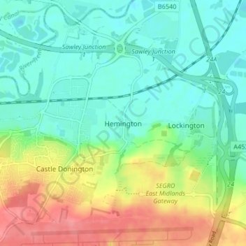
Nombre: Mapa topográfico Hemington, altitud, relieve.
Altitud media: 51 m
Altitud mínima: 26 m
Altitud máxima: 98 m
Otros mapas topográficos
Haga clic en un mapa para ver su topografía, su altitud y su relieve.
Ashby-de-la-Zouch
United Kingdom > England > Leicestershire > North West Leicestershire > Ashby-de-la-Zouch
Ashby-de-la-Zouch, North West Leicestershire, Leicestershire, East Midlands, England, United Kingdom
Altitud media: 132 m
Coalville
United Kingdom > England > Leicestershire > North West Leicestershire
Coalville, North West Leicestershire, Leicestershire, England, LE67 3DW, United Kingdom
Altitud media: 149 m