
Mapa topográfico Wörthsee
Mapa interactivo
Haga clic en el mapa para ver la altitud.
Acerca de este mapa
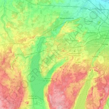
Nombre: Mapa topográfico Wörthsee, altitud, relieve.
Lugar: Wörthsee, Landkreis Starnberg, Bavière, 82237, Allemagne (47.91279 11.04055 48.23279 11.36055)
Altitud media: 589 m
Altitud mínima: 487 m
Altitud máxima: 751 m