
Mapa topográfico Cairo
Mapa interactivo
Haga clic en el mapa para ver la altitud.
Acerca de este mapa
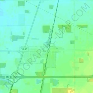
Nombre: Mapa topográfico Cairo, altitud, relieve.
Lugar: Cairo, Allen County, Ohio, 45820, United States (40.82698 -84.09318 40.83927 -84.07743)
Altitud media: 249 m
Altitud mínima: 241 m
Altitud máxima: 261 m
The elevation of the land area of Cairo (ranges from about 812' at the west end to 842' at the east end of the village above sea level) is benchmarked at 815 feet (248 m) above sea level, generally flat and moderately wooded. The nearest stream with year-round flow is Rattlesnake Creek, which flows from south of the village and passes just to the west of the village. Water flow in the village is generally from the south and east to the north and west.
Otros mapas topográficos
Haga clic en un mapa para ver su topografía, su altitud y su relieve.
Lima
United States > Ohio > Allen County
Lima, Allen County, Ohio, 45804, United States
Altitud media: 267 m
Spencerville
United States > Ohio > Allen County
Spencerville, Allen County, Ohio, 45887, United States
Altitud media: 254 m
Bluffton
United States > Ohio > Allen County
Bluffton, Allen County, Ohio, 45817, United States
Altitud media: 255 m
Delphos
United States > Ohio > Allen County
Delphos, Allen County, Ohio, 45833, United States
Altitud media: 236 m
Maysville
United States > Ohio > Allen County
Maysville, Jackson Township, Allen County, Ohio, United States
Altitud media: 307 m
Landeck
United States > Ohio > Allen County
Landeck, Allen County, Ohio, United States
Altitud media: 242 m
Scotts Crossing
United States > Ohio > Allen County
Scotts Crossing, Allen County, Ohio, United States
Altitud media: 239 m
Gomer
United States > Ohio > Allen County
Gomer, Allen County, Ohio, 45809, United States
Altitud media: 237 m
West Newton
United States > Ohio > Allen County
West Newton, Auglaize Township, Allen County, Ohio, United States
Altitud media: 316 m
Southworth
United States > Ohio > Allen County
Southworth, Allen County, Ohio, United States
Altitud media: 247 m
South Warsaw
United States > Ohio > Allen County
South Warsaw, Perry Township, Allen County, Ohio, United States
Altitud media: 283 m
Rockport
United States > Ohio > Allen County
Rockport, Monroe Township, Allen County, Ohio, 45830, United States
Altitud media: 248 m
Conant
United States > Ohio > Allen County
Conant, Allen County, Ohio, United States
Altitud media: 251 m
Allentown
United States > Ohio > Allen County > Lima
Allentown, Lima, Allen County, Ohio, 45805, United States
Altitud media: 250 m
Westminster
United States > Ohio > Allen County
Westminster, Auglaize Township, Allen County, Ohio, United States
Altitud media: 294 m
Elida
United States > Ohio > Allen County
Elida, Allen County, Ohio, United States
Altitud media: 244 m
Beaverdam
United States > Ohio > Allen County
Beaverdam, Allen County, Ohio, 45808, United States
Altitud media: 264 m
Fort Shawnee
United States > Ohio > Allen County
Fort Shawnee, Allen County, Ohio, 45806, United States
Altitud media: 268 m
Lafayette
United States > Ohio > Allen County
Lafayette, Allen County, Ohio, 45854, United States
Altitud media: 286 m
Lima
United States > Ohio > Allen County
Lima, Allen County, Ohio, 45804, United States
Altitud media: 267 m
Harrod
United States > Ohio > Allen County
Harrod, Allen County, Ohio, United States
Altitud media: 305 m