Geolocalizar

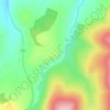
Mapa topográfico Marypark

Haga clic en el mapa para ver la altitud.

Acerca de este mapa

Nombre: Mapa topográfico Marypark, altitud, relieve.

Lugar: Marypark, Moray, Scotland, AB37 9BH, United Kingdom (57.40977 -3.36240 57.44977 -3.32240)

Altitud media: 219 m

Altitud mínima: 122 m

Altitud máxima: 322 m

Otros mapas topográficos

Haga clic en un mapa para ver su topografía, su altitud y su relieve.
Fochabers

United Kingdom > Scotland > Moray

The present village owes its existence to Alexander Gordon, 4th Duke of Gordon (1743–1827). During the late eighteenth century, during the Scottish Enlightenment, it was fashionable for landowners to found new towns and villages; these can be recognised all over Scotland, because unlike their predecessors…

Altitud media: 59 m
River Lossie

United Kingdom > Scotland > Moray

Altitud media: 135 m

River Deveron

United Kingdom > Scotland > Moray

Altitud media: 167 m

River Isla

United Kingdom > Scotland > Moray > Keith

Altitud media: 188 m

River Deveron

United Kingdom > Scotland > Moray

Altitud media: 167 m

Equípate para tu próxima aventura:

🎒Bolsas Estancas - Protección total para electrónica y ropa seca
🧢Gorras de senderismo - Protección solar para actividades al aire libre
🔌Paneles solares portátiles - Carga sostenible en ruta
🎯Silbatos de emergencia - Señalización en situaciones críticas
🛠️Multiherramientas para Bici - Ajustes rápidos para no detener tu aventura

Como asociado de Amazon, este sitio gana comisiones por las compras que califican, sin ningún costo adicional para usted.