
Mapa topográfico Lebanon
Mapa interactivo
Haga clic en el mapa para ver la altitud.
Acerca de este mapa
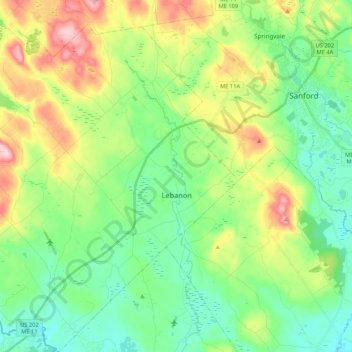
Nombre: Mapa topográfico Lebanon, altitud, relieve.
Lugar: Lebanon, York County, Maine, 04027, United States (43.32569 -70.98843 43.48059 -70.81347)
Altitud media: 121 m
Altitud mínima: 51 m
Altitud máxima: 267 m
According to the United States Census Bureau, the town has a total area of 55.83 square miles (144.60 km2), of which, 55.00 square miles (142.45 km2) of it is land and 0.83 square miles (2.15 km2) is water. Lebanon is drained by the Little River and Salmon Falls River. The town's highest point is Prospect Hill, 880 feet (268 m) above sea level. The lowest elevation borders the Salmon Falls River, on the town's southernmost boundary, which is approximately 170 feet (52 m) above sea level.