
Mapa topográfico Brunswick
Mapa interactivo
Haga clic en el mapa para ver la altitud.
Acerca de este mapa
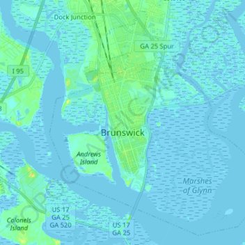
Nombre: Mapa topográfico Brunswick, altitud, relieve.
Altitud media: 2 m
Altitud mínima: -3 m
Altitud máxima: 22 m
The city is the lowest in the state of Georgia, with an elevation of only 10 to 14 feet (3.0 to 4.3 m) above sea level. According to the U.S. Census Bureau, Brunswick's land area is 32.4 square miles (83.8 km2). Its total area is 42.4 square miles (109.8 km2); 10.0 square miles (26.0 km2) of this is water.