
Mapa topográfico Clyde Hill
Mapa interactivo
Haga clic en el mapa para ver la altitud.
Acerca de este mapa
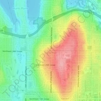
Nombre: Mapa topográfico Clyde Hill, altitud, relieve.
Altitud media: 48 m
Altitud mínima: 0 m
Altitud máxima: 118 m
The top elevation is close to 375 feet. There are approximately 21 miles of public roadway that make Clyde Hill very centrally located within the Seattle - Bellevue metro area.