
Mapa topográfico Tolmezzo
Mapa interactivo
Haga clic en el mapa para ver la altitud.
Acerca de este mapa
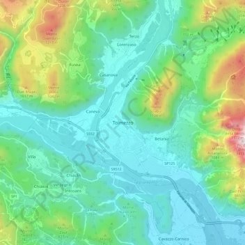
Nombre: Mapa topográfico Tolmezzo, altitud, relieve.
Lugar: Tolmezzo, Udine, Friuli-Venezia Giulia, 33028, Italy (46.36537 12.97584 46.44537 13.05584)
Altitud media: 563 m
Altitud mínima: 263 m
Altitud máxima: 1.532 m
Tolmezzo is located at the foot of the Strabut Mountain, between the Tagliamento River and the Bût stream. Nearby is the Mount Amariana, elevation 1,906 metres (6,253 ft). The commune also includes the five frazioni of Cadunea (Friulian: Cjadugnee), Caneva (Cjanive), Casanova (Cjasegnove), Fusea (Fusee), Illegio (Dieç), Imponzo (Dimponç).