
Mapa topográfico Ashbourne CP
Mapa interactivo
Haga clic en el mapa para ver la altitud.
Acerca de este mapa
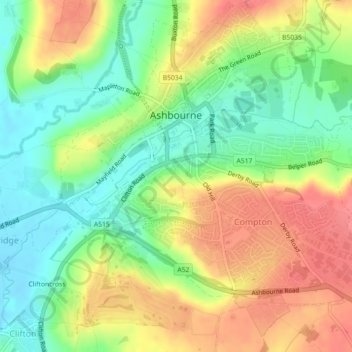
Nombre: Mapa topográfico Ashbourne CP, altitud, relieve.
Altitud media: 147 m
Altitud mínima: 112 m
Altitud máxima: 187 m
Ashbourne lies at 53°01′N 01°44′W / 53.017°N 1.733°W / 53.017; -1.733. Ashbourne Green and Sturston are hamlets close by. Henmore Brook, a tributary of the River Dove, flows through the middle of the town. It has an elevation of 400 feet (122 m).