Geolocalizar

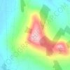
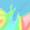
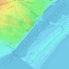
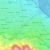
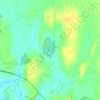
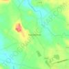
Mapa topográfico Borrmount

Haga clic en el mapa para ver la altitud.

Acerca de este mapa

Nombre: Mapa topográfico Borrmount, altitud, relieve.

Lugar: Borrmount, Bree ED, The Municipal District of Enniscorthy, County Wexford, Leinster, Ireland (52.45290 -6.57830 52.46925 -6.56188)

Altitud media: 26 m

Altitud mínima: -2 m

Altitud máxima: 79 m

Otros mapas topográficos

Haga clic en un mapa para ver su topografía, su altitud y su relieve.
Cork

Ireland > County Cork > Cork

Altitud media: 94 m

Swords

Ireland > County Dublin > Swords

The medieval town developed in a linear pattern along Main Street, in a roughly north-south direction. Swords has one of the best examples of this settlement pattern in the Dublin region. The round tower, 26m in height, is also an indicator of early Christian settlement. The Irish high king Brian Boru is said…

Altitud media: 28 m

River Shannon

Ireland

Altitud media: 39 m

Athlone

Ireland > County Westmeath > Athlone

Altitud media: 44 m

Bolus Head

Ireland

Altitud media: 28 m
Downeen Point

Ireland

Altitud media: 11 m

Galway Bay

Ireland

Altitud media: 0 m

Cromane

Ireland

Altitud media: 3 m

Maghera Strand

Ireland

Altitud media: 37 m

Knockdrin

Ireland

Altitud media: 96 m

Ballycurry

Ireland

Altitud media: 178 m

Ballyedmond

Ireland

Altitud media: 73 m

Furry Glen

Ireland

Altitud media: 44 m

Trout Lake

Ireland

Altitud media: 81 m

Tory Hill

Ireland

Altitud media: 131 m

Dowth

Ireland

Altitud media: 32 m

Great Skellig

Ireland

Altitud media: 1 m

Spinans Hill

Ireland

Altitud media: 244 m

Gaulstown Castle

Ireland

Altitud media: 181 m

Skeaghvasteen

Ireland

Altitud media: 97 m

Tibberaghny Castle

Ireland

Altitud media: 18 m

Myles Big Stone

Ireland

Altitud media: 89 m

Kilkee Cliffs

Ireland

Altitud media: 19 m

Dunlicky Point

Ireland

Altitud media: 18 m

Doulus Head

Ireland

Altitud media: 16 m

Galley Head

Ireland

Altitud media: 3 m

Frower Point

Ireland

Altitud media: 20 m

Knockadoon Head

Ireland

Altitud media: 6 m

Mine Head

Ireland

Altitud media: 22 m

Glendoo Mountain

Ireland

Altitud media: 480 m

Crohy Head Sea Arch

Ireland

Altitud media: 28 m
Dawros Bay

Ireland

Altitud media: 6 m

Portacloy Bay

Ireland

Altitud media: 57 m

Mace Head

Ireland

Altitud media: 3 m

Doonbeg Head

Ireland

Altitud media: 32 m

Lambs Head Bay

Ireland

Altitud media: 14 m

Clifden Bay

Ireland

Altitud media: 41 m

Dollymount

Ireland

Altitud media: 6 m

Greystones

Ireland > County Wicklow

Greystones is located south of the site of an ancient castle of the Barony of Rathdown. There was a hamlet which, like Rathdown Castle, was known as Rathdown, and which appeared on a 1712 map. This site occupied an area now known as the Grove, north of Greystones harbour, but only the ruins of a chapel, St.…

Altitud media: 49 m

Castletownroche

Ireland > County Cork

Altitud media: 67 m

Aughagower

Ireland > County Mayo > Aughagower

Altitud media: 70 m

Ennis

Ireland > County Clare > Ennis

Altitud media: 20 m

Galway City

Ireland > Galway City

Altitud media: 26 m

Belpere Cross

Ireland > County Meath

Altitud media: 111 m

Ballyedmond

Ireland > County Wexford

Altitud media: 74 m

Ballincollig

Ireland > County Cork > Cork

Altitud media: 62 m

Iveagh Gardens

Ireland > County Dublin > Dublin

Altitud media: 17 m

Knocksink Wood

Ireland > County Wicklow

Altitud media: 175 m

Knock

Ireland > County Tipperary

Altitud media: 129 m

Drogheda

Ireland > County Louth > Drogheda

Altitud media: 38 m
Bray

Ireland > County Wicklow > Bray

Altitud media: 58 m

Midleton

Ireland > Midleton

Altitud media: 42 m

Mallow

Ireland > County Cork > Mallow

Altitud media: 106 m

Dundrum

Ireland > County Dublin

Altitud media: 79 m

Howth

Ireland > County Dublin

Altitud media: 8 m

Lucan

Ireland > County Dublin

Altitud media: 59 m

Malahide

Ireland > County Dublin > Malahide

Altitud media: 10 m

Walton's Bog

Ireland > County Kilkenny

Altitud media: 66 m

Cong

Ireland > County Mayo

Altitud media: 23 m

Meelin

Ireland > County Cork

Altitud media: 246 m

Caherlistrane

Ireland > County Galway

Altitud media: 37 m

Clonfert

Ireland > County Galway

Altitud media: 42 m

Carrauntoohil

Ireland > County Kerry

Carrauntoohil is the highest mountain in Ireland on all classification scales. It is the 133rd-highest mountain, and 4th most prominent mountain, in Britain and Ireland, on the Simms classification. Carrauntoohil is regarded by the Scottish Mountaineering Club (SMC) as one of 34 Furths, which are defined as…

Altitud media: 644 m

Claureen River

Ireland > County Clare

Altitud media: 14 m

Mountbellew

Ireland > County Galway

Altitud media: 69 m

Sally Gap

Ireland > County Wicklow

Altitud media: 512 m

Glandore

Ireland > County Cork

Altitud media: 56 m

Blanchardstown

Ireland > County Dublin

Blanchardstown was a predominantly rural area, with a small village, in western County Dublin, alongside the neighbouring district of Castleknock. Both areas shared a common history until well into the 19th century, when their development diverged. In A Topographical Dictionary of Ireland, published in 1837,…

Altitud media: 61 m
Doolin Cave

Ireland > County Clare

Altitud media: 87 m

Slane

Ireland > County Meath > Slane

Altitud media: 68 m

Kilternan

Ireland > County Dublin

Altitud media: 173 m

Limerick

Ireland > County Limerick > Limerick

Limerick's climate is classified as temperate oceanic (Köppen Cfb). Met Éireann maintains a climatological weather station at Shannon Airport, 20 kilometres west of the city in County Clare. Shannon Airport records an average of 977 millimetres of precipitation annually, most of which is rain. Limerick has a…

Altitud media: 10 m

Kildare Round Tower

Ireland > County Kildare

A Topographical Dictionary of Ireland states "One of the ancient round towers stood here till 1807 when it was pulled down to make room for the belfry of the church".

Altitud media: 100 m

Scartaglen

Ireland > County Kerry

Altitud media: 135 m

Hill of Slane

Ireland > County Meath

Altitud media: 88 m

Belgooly

Ireland > County Cork > Belgooly

Altitud media: 51 m

Firies

Ireland > County Kerry

Altitud media: 31 m

Galley Head

Ireland > County Cork

Altitud media: 6 m

Ballyvoye

Ireland > County Cork

Altitud media: 50 m

High Island

Ireland > County Galway

Altitud media: 1 m

Bealaha

Ireland > County Clare

Altitud media: 17 m

Staigue Fort

Ireland > County Kerry

Altitud media: 191 m

Ennistimon

Ireland > County Clare > Ennistimon

Altitud media: 61 m

Kells Round Tower

Ireland > County Meath

Altitud media: 69 m

Kerry Pike

Ireland > County Cork > Cork

Altitud media: 55 m

Lough Bunny

Ireland > County Clare

Altitud media: 23 m

Ballycommon

Ireland > County Tipperary

Altitud media: 48 m

Milford

Ireland > County Cork

Altitud media: 119 m

Equípate para tu próxima aventura:

📟Altímetros Digitales - Precisión en la medición de la elevación y presión atmosférica
👟Sandalias de Trekking Mujer - Protección y frescura para el verano
🛰️Dispositivos GPS de Mano - Navegación precisa con mapas topográficos de alta resolución
⛺Tarps y Toldos de Refugio - Protección versátil contra la lluvia y el sol
🧣Buff multifuncional - Protección cuello y cabeza

Como asociado de Amazon, este sitio gana comisiones por las compras que califican, sin ningún costo adicional para usted.