

Mapa topográfico Royal Pines
Haga clic en el mapa para ver la altitud.
Royal Pines
Royal Pines is located in southern Buncombe County at 35°28′39″N 82°30′35″W / 35.47750°N 82.50972°W / 35.47750; -82.50972 (35.477386, -82.509833). It is bordered to the west by U.S. Route 25A and the city limits of Asheville, and to the northeast by Mills Gap Road. Brown Mountain, with an elevation of 2,996 feet (913 m), occupies the center of the CDP.
Acerca de este mapa
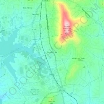
Nombre: Mapa topográfico Royal Pines, altitud, relieve.
Altitud media: 700 m
Altitud mínima: 637 m
Altitud máxima: 903 m
Otros mapas topográficos
Haga clic en un mapa para ver su topografía, su altitud y su relieve.

Haw Creek Park
United States > North Carolina > Buncombe County > Asheville > Dogwood Grove
Altitud media: 666 m

Falconhurst-West Asheville Preserve
United States > North Carolina > Buncombe County > Asheville
Altitud media: 647 m