
Mapa topográfico Brenner Pass
Mapa interactivo
Haga clic en el mapa para ver la altitud.
Brenner Pass
The Brenner Pass (German: Brennerpass [ˈbʁɛnɐpas], shortly Brenner; Italian: Passo del Brennero [ˈpasso del ˈbrɛnnero]) is a mountain pass over the Alps which forms the border between Italy and Austria. It is one of the principal passes of the Eastern Alpine range and has the lowest altitude among Alpine passes of the area.
Acerca de este mapa
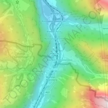
Nombre: Mapa topográfico Brenner Pass, altitud, relieve.
Altitud media: 1.635 m
Altitud mínima: 1.309 m
Altitud máxima: 2.252 m