
Mapa topográfico Bonvilston
Mapa interactivo
Haga clic en el mapa para ver la altitud.
Acerca de este mapa
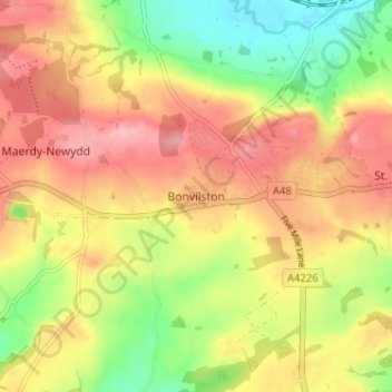
Nombre: Mapa topográfico Bonvilston, altitud, relieve.
Lugar: Bonvilston, Vale of Glamorgan, Wales, CF5 6TY, United Kingdom (51.43855 -3.36566 51.47855 -3.32566)
Altitud media: 83 m
Altitud mínima: 17 m
Altitud máxima: 137 m
In the 19th century, Richard Bassett, a prominent figure in Glamorgan resided at Bonvilston House and owned the manor. The 1811 A Topographical Dictionary of The Dominion of Wales by Nicholas Carlisle said of the village: