
Haz una donación
Equípate para tu próxima aventura:
Como asociado de Amazon, este sitio gana comisiones por las compras que califican, sin ningún costo adicional para usted.
Mapa topográfico Rodeo
Haga clic en el mapa para ver la altitud.
Haz una donación
Equípate para tu próxima aventura:
Como asociado de Amazon, este sitio gana comisiones por las compras que califican, sin ningún costo adicional para usted.
Acerca de este mapa
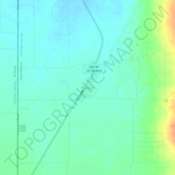
Nombre: Mapa topográfico Rodeo, altitud, relieve.
Lugar: Rodeo, Hidalgo County, New Mexico, 88056, United States (31.81644 -109.05031 31.85644 -109.01031)
Altitud media: 1.262 m
Altitud mínima: 1.251 m
Altitud máxima: 1.293 m
Haz una donación
Equípate para tu próxima aventura:
Como asociado de Amazon, este sitio gana comisiones por las compras que califican, sin ningún costo adicional para usted.
Otros mapas topográficos
Haga clic en un mapa para ver su topografía, su altitud y su relieve.
Lordsburg
United States > New Mexico > Hidalgo County
Typical for the more southerly and lower elevations of the Intermountain West, summers are extremely hot during the daytime, with maxima above 90 °F or 32.2 °C for over four months on an average of 122 afternoons during a full year. 100 °F or 37.8 °C is exceeded on average during 30 afternoons each year,…
Altitud media: 1.309 m