
Mapa topográfico Strefford
Haga clic en el mapa para ver la altitud.
Strefford
It lies in the civil parish of Wistanstow and is situated just off the A49 road, 2 miles (3.2 km) north of the small town of Craven Arms. The nearest settlement is Upper Affcot, a hamlet located north of the A49, with a public house. Strefford is situated at an elevation between 130 metres (430 ft) and 135m, and just to the east is Strefford Wood, which is at the southern end of Wenlock Edge; the bridleway that runs along the Edge ends just outside the hamlet.
Acerca de este mapa
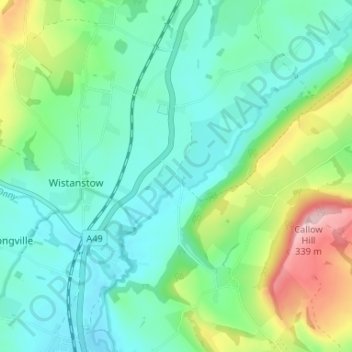
Nombre: Mapa topográfico Strefford, altitud, relieve.
Altitud media: 175 m
Altitud mínima: 118 m
Altitud máxima: 335 m
Otros mapas topográficos
Haga clic en un mapa para ver su topografía, su altitud y su relieve.