
Mapa topográfico Harker Heights
Mapa interactivo
Haga clic en el mapa para ver la altitud.
Acerca de este mapa
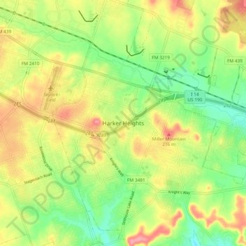
Nombre: Mapa topográfico Harker Heights, altitud, relieve.
Lugar: Harker Heights, Bell County, Texas, 76548, United States (31.03463 -97.69905 31.11463 -97.61905)
Altitud media: 240 m
Altitud mínima: 198 m
Altitud máxima: 288 m