
Mapa topográfico Devín Castle
Mapa interactivo
Haga clic en el mapa para ver la altitud.
Acerca de este mapa
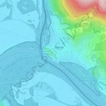
Nombre: Mapa topográfico Devín Castle, altitud, relieve.
Altitud media: 175 m
Altitud mínima: 137 m
Altitud máxima: 453 m
The cliff (elevation 212 meters) is an ideal place for a fort due to its position at the confluence of the Danube and Morava rivers. The fort watches over an important trade route along the Danube as well as one branch of the Amber Road.