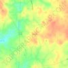
Mapa topográfico Jordan Lake
Haga clic en el mapa para ver la altitud.
Jordan Lake
The Jordan Lake Dam (also known as the B. Everett Jordan Project and the New Hope Dam) is located at 35°39′15″N 79°4′0″W / 35.65417°N 79.06667°W / 35.65417; -79.06667 (B. Everett Jordan Dam) 4 miles (6.4 km) upstream from the mouth of the Haw River in the upper Cape Fear River drainage basin. Completed in 1974 by the Nello L. Teer Company, it is 1,330 feet (410 m) in length and has a top elevation of 266.5 feet (81.2 m) above mean sea level.
Acerca de este mapa

Nombre: Mapa topográfico Jordan Lake, altitud, relieve.
Lugar: Jordan Lake, Chatham County, North Carolina, United States (35.64128 -79.10467 35.86993 -78.94848)
Altitud media: 102 m
Altitud mínima: 52 m
Altitud máxima: 223 m
Otros mapas topográficos
Haga clic en un mapa para ver su topografía, su altitud y su relieve.


Town of Pittsboro
United States > North Carolina > Chatham County > Town of Pittsboro
Altitud media: 123 m