Mapa topográfico Piravom
Haga clic en el mapa para ver la altitud.
Piravom
Piravom was reverted to panchayat status in 1992 after two years as a municipality because of skepticism that its classification as a municipality would attract higher tax rates and building regulation. However, as modern municipal councils now have the authority to fix the tax rate and new building rule provisions are now applicable to special grade panchayats, the economic incentive for Piravom remaining a panchayat has disappeared. The local government of Piravom passed a unanimous resolution for elevation to municipality status. In 2015,The government of Kerala reclassified Piravom as a municipality.In 2021-2022, 2022-2023 LDF ruling Piravom municipality achieved 1st in the state for Ardra Keralam Award of Kerala Government on Best Health-services,cleanliness in the state .
Acerca de este mapa
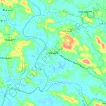
Nombre: Mapa topográfico Piravom, altitud, relieve.
Lugar: Piravom, Muvattupuzha, Ernakulam, Kerala, 686664, India (9.83337 76.45227 9.91337 76.53227)
Altitud media: 23 m
Altitud mínima: -1 m
Altitud máxima: 111 m
Otros mapas topográficos
Haga clic en un mapa para ver su topografía, su altitud y su relieve.