

Mapa topográfico Wyatt
Haga clic en el mapa para ver la altitud.
Acerca de este mapa

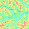
Nombre: Mapa topográfico Wyatt, altitud, relieve.
Lugar: Wyatt, Harrison County, West Virginia, United States (39.41509 -80.37342 39.45509 -80.33342)
Altitud media: 356 m
Altitud mínima: 284 m
Altitud máxima: 463 m
Otros mapas topográficos
Haga clic en un mapa para ver su topografía, su altitud y su relieve.

Clarksburg
United States > West Virginia > Harrison County
Clarksburg had a humid continental climate if one considers the 0 °C isotherm. The latest temperature numbers have the climate as humid subtropical (Cfa). To the molds of Köppen the climate may be considered the southern boundary of the Dfb zone at low altitudes in the North American continent (limit of 39…
Altitud media: 347 m
Clarksburg
United States > West Virginia > Harrison County
Clarksburg is located at the junction of U.S. 50 and U.S. 19, two miles west of the junction of U.S. 50 with Interstate 79. The city lies at an elevation of 1,007 feet at the junction of Elk Creek and the West Fork River of the Monongahela River.
Altitud media: 347 m
Clarksburg City Park
United States > West Virginia > Harrison County > Nutter Fort
Altitud media: 335 m