
Mapa topográfico Ayder
Mapa interactivo
Haga clic en el mapa para ver la altitud.
Acerca de este mapa
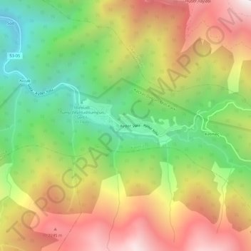
Nombre: Mapa topográfico Ayder, altitud, relieve.
Altitud media: 1.683 m
Altitud mínima: 936 m
Altitud máxima: 2.527 m
Ayder at 40°57′N 41°05′E / 40.950°N 41.083°E / 40.950; 41.083 is a typical yayla with no settled population; it hosts visitors during summers. The average altitude is 1,350 metres (4,430 ft). It is a part of Çamlıhemşin District of Rize Province. The distance to Çamlıhemşin is 17 kilometres (11 mi) and to Rize is 88 kilometres (55 mi).