
Mapa topográfico Vinita
Mapa interactivo
Haga clic en el mapa para ver la altitud.
Acerca de este mapa
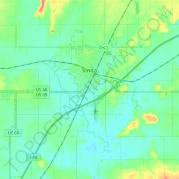
Nombre: Mapa topográfico Vinita, altitud, relieve.
Lugar: Vinita, Craig County, Oklahoma, 74301, United States (36.58978 -95.26966 36.66675 -95.12560)
Altitud media: 213 m
Altitud mínima: 200 m
Altitud máxima: 259 m
Vinita is located in northeastern Oklahoma, a region of the state known as Green Country. According to the Vinita Chamber of Commerce, the town is often called the "Crossroads to Green Country." It sits at the base of the Ozark Highlands topographical region in a mix of prairie and forest. It is located in southern Craig County.