Geolocalizar

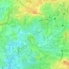
Mapa topográfico Santol

Haga clic en el mapa para ver la altitud.

Acerca de este mapa

Nombre: Mapa topográfico Santol, altitud, relieve.

Lugar: Santol, Galas, 4th District, Quezon City, Eastern Manila District, Metro Manila, 1113, Philippines (14.60449 121.01205 14.61533 121.01871)

Altitud media: 12 m

Altitud mínima: 1 m

Altitud máxima: 33 m

Otros mapas topográficos

Haga clic en un mapa para ver su topografía, su altitud y su relieve.

Talayan Park

Philippines > Quezon City

Altitud media: 16 m

Tullahan River

Philippines > Quezon City

Altitud media: 39 m

La Mesa Eco Park

Philippines > Quezon City

Covering an area of 33 hectares (82 acres) the public park is located along the natural boundary of the La Mesa Watershed Reservation and its elevation is about 40 metres (130 ft) below than the resorvoir.

Altitud media: 66 m
La Mesa Dam

Philippines > Quezon City

The La Mesa was built in Novaliches, which was then still part of the municipality of Caloocan due to the sloping topography of the watershed area from Bulacan. The La Mesa dam later became part of a larger dam system with the opening of the Ipo Dam in Norzagaray, Bulacan in 1936, the Angat Dam in the same…

Altitud media: 65 m

Tullahan River

Philippines > Quezon City

Altitud media: 39 m

Culiat Creek

Philippines > Quezon City

Altitud media: 44 m

Bernardo Park

Philippines > Quezon City

Altitud media: 41 m

Diliman Creek

Philippines > Quezon City

Altitud media: 23 m

Tullahan River

Philippines > Quezon City

Altitud media: 46 m

Culiat Creek

Philippines > Quezon City

Altitud media: 41 m

Sunken Garden

Philippines > Quezon City

Altitud media: 62 m

Tullahan River

Philippines > Quezon City

Altitud media: 31 m

La Mesa Dam

Philippines > Quezon City

The La Mesa was built in Novaliches, which was then still part of the municipality of Caloocan due to the sloping topography of the watershed area from Bulacan. The La Mesa dam later became part of a larger dam system with the opening of the Ipo Dam in Norzagaray, Bulacan in 1936, the Angat Dam in the same…

Altitud media: 65 m

Payatas B

Philippines > Quezon City

Altitud media: 60 m

Culiat Creek

Philippines > Quezon City

Altitud media: 27 m

Equípate para tu próxima aventura:

🧭Brújulas de orientación - Brújulas precisas para navegación y montaña
🧴Cremas Anti-rozaduras - Protección para pies y muslos en rutas largas
🪵Hornillos de camping - Cocina portátil para exterior
👣Polainas de Montaña - Protección contra el barro, nieve y agua en tus piernas
📚Mapas Físicos de España - Cartografía detallada para estudio y planificación

Como asociado de Amazon, este sitio gana comisiones por las compras que califican, sin ningún costo adicional para usted.