Mapa topográfico Hurley
Haga clic en el mapa para ver la altitud.
Hurley
Hurley was at the center of a boundary dispute between Michigan and Wisconsin, culminating in a United States Supreme Court case in 1926, confirming Hurley belonging to Wisconsin. The Montreal River was mapped in detail in 1841 by Lieutenant Thomas Jefferson Cram of the United States Land Office Department of Topography. Cram was assigned by Congress to survey the northeast boundary between Michigan and Wisconsin. This boundary had been originally outlined by Congress in 1834 on the basis of the faulty maps of the time which incorrectly showed both the Montreal and Menominee rivers originating from the Lac Vieux Desert in Vilas County. After a detailed survey, Cram located the headwaters of the Montreal 55 miles west of Lac Vieux Desert, and recommended the boundary line be run from the center of the lake to the headwaters of the Montreal. Michigan brought suit against Wisconsin to correct the boundary line between the two states. Michigan's claim included the City of Hurley and its valuable mineral deposits. Michigan's lawsuit, Michigan v. Wisconsin (270 U.S. 295, 1926), was dismissed by the US Supreme Court on the grounds that Wisconsin's long continued possession of the disputed property was acquiesced in by Michigan (P. 270, U.S. 301).
Acerca de este mapa
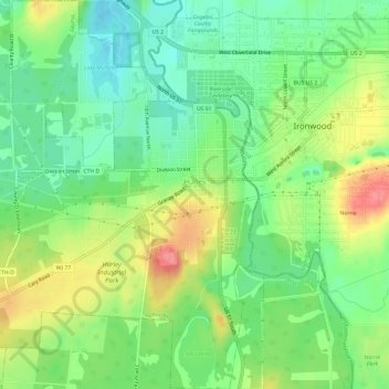
Nombre: Mapa topográfico Hurley, altitud, relieve.
Lugar: Hurley, Iron County, Wisconsin, United States (46.42761 -90.22094 46.46885 -90.17671)
Altitud media: 455 m
Altitud mínima: 423 m
Altitud máxima: 503 m
Otros mapas topográficos
Haga clic en un mapa para ver su topografía, su altitud y su relieve.
Manitowish River
United States > Wisconsin > Iron County > Town of Mercer > Manitowish
Altitud media: 486 m