
Haz una donación
Equípate para tu próxima aventura:
Como asociado de Amazon, este sitio gana comisiones por las compras que califican, sin ningún costo adicional para usted.
Mapa topográfico Clark Fork
Haga clic en el mapa para ver la altitud.
Haz una donación
Equípate para tu próxima aventura:
Como asociado de Amazon, este sitio gana comisiones por las compras que califican, sin ningún costo adicional para usted.
Clark Fork
Clark Fork is located at 48°8′50″N 116°10′42″W / 48.14722°N 116.17833°W / 48.14722; -116.17833 (48.147180, -116.178270), at an elevation of 2,090 feet (637 m) above sea level. The town is situated on the Clark Fork River, on the eastern shores of Lake Pend Oreille. in the northern panhandle of the state. According to the United States Census Bureau, the city has a total area of 0.92 square miles (2.38 km2), all of it land. The Lightning Creek passes just north and west of the town.
Haz una donación
Equípate para tu próxima aventura:
Como asociado de Amazon, este sitio gana comisiones por las compras que califican, sin ningún costo adicional para usted.
Acerca de este mapa
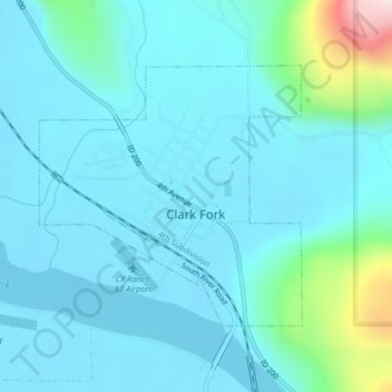
Nombre: Mapa topográfico Clark Fork, altitud, relieve.
Lugar: Clark Fork, Bonner County, Idaho, 83811, United States (48.13748 -116.19191 48.15545 -116.16474)
Altitud media: 681 m
Altitud mínima: 625 m
Altitud máxima: 1.040 m
Haz una donación
Equípate para tu próxima aventura:
Como asociado de Amazon, este sitio gana comisiones por las compras que califican, sin ningún costo adicional para usted.
Otros mapas topográficos
Haga clic en un mapa para ver su topografía, su altitud y su relieve.
Haz una donación
Equípate para tu próxima aventura:
Como asociado de Amazon, este sitio gana comisiones por las compras que califican, sin ningún costo adicional para usted.
Haz una donación
Equípate para tu próxima aventura:
Como asociado de Amazon, este sitio gana comisiones por las compras que califican, sin ningún costo adicional para usted.