
Mapa topográfico Izena
Mapa interactivo
Haga clic en el mapa para ver la altitud.
Acerca de este mapa
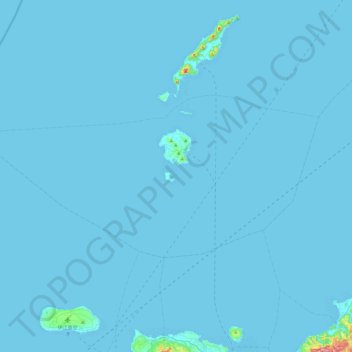
Nombre: Mapa topográfico Izena, altitud, relieve.
Lugar: Izena, Shimajiri, Okinawa Prefecture, Japan (26.79814 127.64823 26.99760 128.13152)
Altitud media: 3 m
Altitud mínima: 0 m
Altitud máxima: 335 m
The island's topography features a row of mountains spanning from the northwest to the southeast of the island, with generally flat, arable land covering the remainder. The island has several sandy beaches and designated camping areas with bathroom facilities. The view of Izena's rocky southern coastline is well known as one of Japan's best, with the rock formations 'Umi Gitara' and 'Agi Gitara' dramatically rising from the land and sea.
Otros mapas topográficos
Haga clic en un mapa para ver su topografía, su altitud y su relieve.