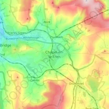
Mapa topográfico Chapel-en-le-Frith
Mapa interactivo
Haga clic en el mapa para ver la altitud.
Acerca de este mapa
Nombre: Mapa topográfico Chapel-en-le-Frith, altitud, relieve.
Altitud media: 324 m
Altitud mínima: 150 m
Altitud máxima: 572 m

Haga clic en el mapa para ver la altitud.
Nombre: Mapa topográfico Chapel-en-le-Frith, altitud, relieve.
Altitud media: 324 m
Altitud mínima: 150 m
Altitud máxima: 572 m