
Mapa topográfico Soča
Mapa interactivo
Haga clic en el mapa para ver la altitud.
Acerca de este mapa
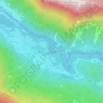
Nombre: Mapa topográfico Soča, altitud, relieve.
Lugar: Soča, Ograjenca, Srpenica, Bovec, 5224, Slovenia (46.28560 13.50800 46.29243 13.51956)
Altitud media: 622 m
Altitud mínima: 316 m
Altitud máxima: 1.474 m
An Alpine river in character, its source lies in the Trenta Valley in the Julian Alps in northwestern Slovenia, at an elevation of 876 metres (2,874 ft). The river runs past the towns of Bovec, Kobarid, Tolmin, Kanal ob Soči, Nova Gorica (where it is crossed by the Solkan Bridge), and Gorizia, entering the Adriatic Sea close to the town of Monfalcone. It has a nival-pluvial regime in its upper course and pluvial-nival in its lower course.