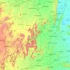
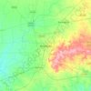
Mapa topográfico Nevasa
Haga clic en el mapa para ver la altitud.
Acerca de este mapa

Nombre: Mapa topográfico Nevasa, altitud, relieve.
Lugar: Nevasa, Ahmednagar District, India (19.26772 74.76665 19.66549 75.20706)
Altitud media: 501 m
Altitud mínima: 457 m
Altitud máxima: 839 m
Otros mapas topográficos
Haga clic en un mapa para ver su topografía, su altitud y su relieve.
Bhubaneshwar
India > Odisha > Bhubaneswar (M.Corp.)
Bhubaneswar is in Khordha district of Odisha. It is in the eastern coastal plains, along the axis of the Eastern Ghats mountains. The city has an average altitude of 45 m (148 ft) above sea level. It lies southwest of the Mahanadi River that forms the northern boundary of Bhubaneswar metropolitan area, within…
Altitud media: 30 m


Bobbili
India > Andhra Pradesh > Bobbili
Bobbili is located at 18°34′00″N 83°22′00″E / 18.5667°N 83.3667°E / 18.5667; 83.3667. It has an average elevation of 103 metres (337 feet).
Altitud media: 130 m
Ajinkyatara Fort
India > Maharashtra > Satara > Satara
Ajinkyatara Fort, also known as the "Fort of the Sapta-Rishi," is a historical hill fort located on Ajinkyatara Mountain, one of the seven mountains surrounding the city of Satara in the Sahyadri Mountains of Maharashtra, India. Situated at an altitude of 3,300 feet, the fort overlooks Satara City and is…
Altitud media: 764 m

Panvel
India > Maharashtra > Panvel > Panvel
Matheran is a hill station and a municipal council in the Raigad district in the Indian state of Maharashtra. It is a hill station in Karjat Tahsil and is also the smallest hill station in India. It is located on the Western Ghats range at an elevation of around 800 m (2,625 feet) above sea level. It is…
Altitud media: 75 m
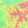
Shimla
Shimla is on the south-western ranges of the Himalayas at 31°37′N 77°06′E / 31.61°N 77.10°E / 31.61; 77.10. It has an average altitude of 2,206 metres (7,238 ft) above mean sea level and extends along a ridge with seven spurs. The city stretches nearly 9.2 kilometres (5.7 mi) from east to west.
Altitud media: 1.557 m
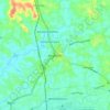


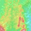


Nainital
India > Uttarakhand > Nainital
The city of Nainital covers a total area of 11.73 km2 (4.53 sq mi), and is located at 29°23′N 79°27′E / 29.38°N 79.45°E / 29.38; 79.45, at an average elevation of 2,084 metres (6,837 ft) above sea level. The slopes of the nearby mountains are most populated, with an elevation ranging from…
Altitud media: 1.813 m
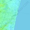
Chennai
Chennai is located on the south–eastern coast of India in the north–eastern part of Tamil Nadu on a flat coastal plain known as the Eastern Coastal Plains. Its average elevation is around 6.7 metres (22 ft), and its highest point is 60 m (200 ft). Chennai is 2,184 kilometres (1,357 mi) south of Delhi,…
Altitud media: 7 m

Shimla
Shimla is on the south-western ranges of the Himalayas at 31°37′N 77°06′E / 31.61°N 77.10°E / 31.61; 77.10. It has an average altitude of 2,206 metres (7,238 ft) above mean sea level and extends along a ridge with seven spurs. The city stretches nearly 9.2 kilometres (5.7 mi) from east to west.
Altitud media: 1.557 m
Mangaluru
India > Karnataka > Mangaluru taluk
Mangalore is also the administrative headquarters of the Dakshina Kannada district; it is a commercial, industrial, educational, healthcare, and startup hub. The city's international airport is the second-largest and second-busiest airport in Karnataka. Mangalore City Corporation is responsible for the civic…
Altitud media: 25 m

Thrippunithura
India > Kerala > Kanayannur
In the south, Thrippunithura borders the Vembanad, the longest lake in India. The lake provides facilities for inland water navigation, with the Champakkara canal stretch of the National Waterway 3 forming its western boundary with Kochi and Maradu. The canal then merges with the Chithrapuzha river in the…
Altitud media: 8 m












Maharashtra
Maharashtra is the third largest state by area in India. The Western Ghats better known as Sahyadri, are a hilly range running parallel to the coast, at an average elevation of 1,200 metres (4,000 ft). Kalsubai, a peak in the Sahyadris, near Nashik city is the highest elevated point in Maharashtra. To the west…
Altitud media: 478 m


Guwahati
Professor Abani Kumar Bhagawati of Gauhati University stated that since before there were sufficient wetlands to absorb rainwater and channels to carry excess water to the Brahmaputra, the city did not experience floods. However, human interference has disrupted the natural topography, leading to the current…
Altitud media: 113 m
Mumbai
The majority of the city lies just above the mean sea level, with elevations ranging from 10 to 15 m (33 to 49 ft), and an average elevation of 14 m (46 ft). Northern Mumbai consists of hilly terrain, with the highest point in the city at 450 m (1,480 ft) in the Powai–Kanheri range. The coastline is indented…
Altitud media: 13 m


Malegaon
India > Maharashtra > Malegaon Taluka
Malegaon(previously Maligaon) is at the confluence of the Girna and Mosam (previously Moosy) rivers, at elevation of 438 metres (1437 feet) at 18°25′N 77°32′E / 18.42°N 77.53°E / 18.42; 77.53.
Altitud media: 463 m


Chandauli
India > Uttar Pradesh > Chandauli
Chandauli is located at 25°16′N 83°16′E / 25.27°N 83.27°E / 25.27; 83.27. It has an average elevation of 70 metres (230 ft). Located about 30 kilometers from Varanasi, it comes under Varanasi division of Uttar Pradesh. Mughalsarai, a major railway junction between northern and eastern India is…
Altitud media: 76 m






Dasuya
India > Punjab > Dasua Tahsil
Dasuya is located in Hoshiarpur district of Punjab state in India. at 31°49′N 75°40′E / 31.82°N 75.66°E / 31.82; 75.66. It has an average elevation of 239 metres (784 ft) from sea level.
Altitud media: 254 m



Amravati
India > Maharashtra > Amravati
Amravati is located at 20°56′N 77°45′E / 20.93°N 77.75°E / 20.93; 77.75. It has an average elevation of 343 meters (1125 feet). It lies 156 km (97 mi) west of Nagpur and serves as the administrative centre of Amravati District and of Amravati Division. The city is located near the passes…
Altitud media: 345 m