
Mapa topográfico Grandfather Mountain State Park
Mapa interactivo
Haga clic en el mapa para ver la altitud.
Grandfather Mountain State Park
Grandfather Mountain rises 5,964 feet above sea level, and due to the considerable elevation gain the mountain boasts 16 distinct ecological communities. The mountain is famous for its rugged character, and is home to many hidden caves and significant cliffs.
Acerca de este mapa
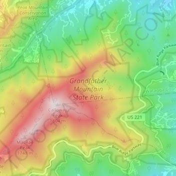
Nombre: Mapa topográfico Grandfather Mountain State Park, altitud, relieve.
Altitud media: 1.293 m
Altitud mínima: 949 m
Altitud máxima: 1.789 m