Mapa topográfico Terracina
Haga clic en el mapa para ver la altitud.
Terracina
Above the town are several massive terrace platforms for supporting buildings; these may well belong to the Roman period, and the latter even to the Empire. The summit of the promontory, elevation 227 metres (745 ft), is reached by the old line of the Via Appia, which is flanked by tombs and by remains of an ancient defensive wall with circular towers, the so-called Cinta Sillana (once attributed to Theodoric, but dating from the first decades of the 1st century BCE). The summit is occupied by a large terrace, supported by arcades of fine opus incertum (traditionally, but wrongly, called the "palace of Theodoric") on all sides except the east, with views seaward over the coast and over the Pontine Marshes.
Acerca de este mapa
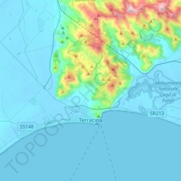
Nombre: Mapa topográfico Terracina, altitud, relieve.
Lugar: Terracina, Latina, Lazio, Italy (41.25845 13.06086 41.37844 13.31369)
Altitud media: 121 m
Altitud mínima: -4 m
Altitud máxima: 1.066 m
Otros mapas topográficos
Haga clic en un mapa para ver su topografía, su altitud y su relieve.