

Mapa topográfico Dal Lake
Haga clic en el mapa para ver la altitud.
Dal Lake
The average elevation of the lake is 1,583 metres (5,194 ft). The depth of water varies from 6 metres (20 ft) at its deepest in Nigeen lake to 2.5 metres (8.2 ft), the shallowest at Gagribal. The depth ratio between the maximum and minimum depths varies with the season between 0.29 and 0.25, which is interpreted as flat bed slope. The length of the lake is 7.44 kilometres (4.62 mi) with a width of 3.5 kilometres (2.2 mi). The lake has a basin having shore length of 15.5 kilometres (9.6 mi) and roads run all along the periphery. Irreversible changes through urban developments have placed further restrictions on the flow of the lake and as a result, marshy lands have emerged on the peripheral zones, notably in the foothill areas of the Shankaracharya and Zaharbwan hills. These marshy lands have since been reclaimed and converted into large residential complexes.
Acerca de este mapa
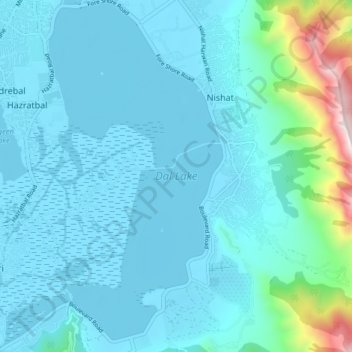
Nombre: Mapa topográfico Dal Lake, altitud, relieve.
Altitud media: 1.715 m
Altitud mínima: 1.580 m
Altitud máxima: 2.716 m