
Mapa topográfico North Amherst
Mapa interactivo
Haga clic en el mapa para ver la altitud.
Acerca de este mapa
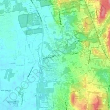
Nombre: Mapa topográfico North Amherst, altitud, relieve.
Altitud media: 67 m
Altitud mínima: 37 m
Altitud máxima: 145 m
Otros mapas topográficos
Haga clic en un mapa para ver su topografía, su altitud y su relieve.
South Amherst
United States > Massachusetts > Hampshire County > Amherst
South Amherst, Amherst, Hampshire County, Massachusetts, 01004, United States
Altitud media: 60 m
Fort River
United States > Massachusetts > Hampshire County > Amherst
Fort River, Amherst, Hampshire County, Massachusetts, United States
Altitud media: 59 m
Amherst Woods
United States > Massachusetts > Hampshire County > Amherst > Amherst Woods
Amherst Woods, Amherst, Hampshire County, Massachusetts, 01004, United States
Altitud media: 84 m