
Mapa topográfico Broad Peak
Mapa interactivo
Haga clic en el mapa para ver la altitud.
Acerca de este mapa
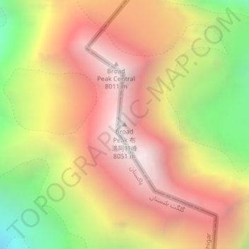
Nombre: Mapa topográfico Broad Peak, altitud, relieve.
Altitud media: 7.127 m
Altitud mínima: 5.915 m
Altitud máxima: 8.030 m
Broad Peak (Balti: ཕ༹ལ་ཆན་གངས་རི་།, romanized: Falchan Kangri, lit. 'Broad Peak'; Urdu: بروڈ پیک) is one of the eight-thousanders, and is located in the Karakoram range spanning Gilgit-Baltistan, Pakistan and Xinjiang, China. It is the 12th highest mountain in the world with 8,051 metres (26,414 ft) elevation above sea level. The first ascent of this mountain was in June 1957, accomplished by Fritz Wintersteller, Marcus Schmuck, Kurt Diemberger, and Hermann Buhl as part of an Austrian expedition.