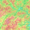
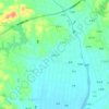
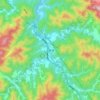
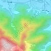
Mapa topográfico Anji County
Haga clic en el mapa para ver la altitud.
Anji County
Anji County is located within the Yangtze Delta, where the Yangtze meets the East China Sea. The Tianmu Mountains run through southwest portion of the county, with the county's highest point, Longwang Mountain [zh], reaching 1,587.4 metres (5,208 ft) in elevation. Xitiao River, the county's longest river, flows from the southwest mountains northeast, before eventually emptying into Lake Tai.
Acerca de este mapa

Nombre: Mapa topográfico Anji County, altitud, relieve.
Lugar: Anji County, Huzhou, Zhejiang, 311200, China (30.37562 119.23240 30.87466 119.88466)
Altitud media: 207 m
Altitud mínima: -1 m
Altitud máxima: 1.554 m
Otros mapas topográficos
Haga clic en un mapa para ver su topografía, su altitud y su relieve.