
Mapa topográfico Bajardo
Mapa interactivo
Haga clic en el mapa para ver la altitud.
Acerca de este mapa
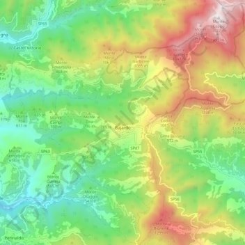
Nombre: Mapa topográfico Bajardo, altitud, relieve.
Lugar: Bajardo, Imperia, Liguria, 18031, Italy (43.86526 7.68489 43.94367 7.77718)
Altitud media: 710 m
Altitud mínima: 161 m
Altitud máxima: 1.610 m
Its principal settlement, Bajardo itself, is a medieval village which stands at an elevation of 900 metres (3,000 ft) on a peak at the head of the basin of the Nervia torrent.