

Mapa topográfico Jamshedpur
Haga clic en el mapa para ver la altitud.
Jamshedpur
Jamshedpur is situated in the southern end of the state of Jharkhand and is bordered by the states of Odisha and West Bengal. The average elevation of the city is 135 metres while the range is from 129 m to 151 m. Total geographical area of Jamshedpur is 224 km square. Jamshedpur is primarily located in a hilly region and is surrounded by the Dalma Hills running from west to east and covered with dense forests. The other smaller hill ranges near the city are Ukam Hill and the Jadugoda-musabani hill range. The city is also a part of the larger Chota Nagpur Plateau region. The region is formed of the sedimentary, metamorphic and igneous rocks belonging to the Dharwarian period.
Acerca de este mapa
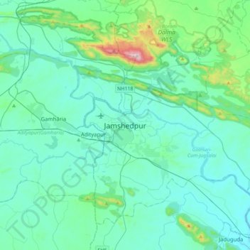
Nombre: Mapa topográfico Jamshedpur, altitud, relieve.
Altitud media: 195 m
Altitud mínima: 90 m
Altitud máxima: 915 m