
Mapa topográfico Mt. Yamato-Katsuragi
Mapa interactivo
Haga clic en el mapa para ver la altitud.
Acerca de este mapa
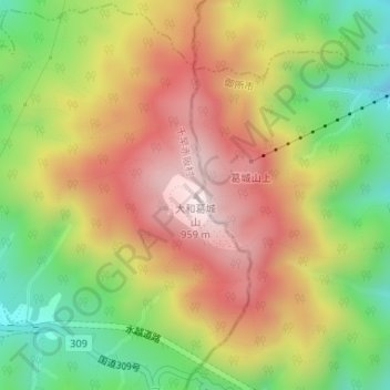
Nombre: Mapa topográfico Mt. Yamato-Katsuragi, altitud, relieve.
Altitud media: 653 m
Altitud mínima: 344 m
Altitud máxima: 952 m
Mount Yamato Katsuragi (大和葛城山, Yamato Katsuragi-san) or simply Mount Katsuragi is a mountain in the Kongō Range straddling the prefectural border between Chihayaakasaka, Osaka and Gose, Nara in Japan. The peak elevation is 959.2 metres (3,147 ft). The mountain is located along the Gose Line of the Kintetsu Railway.